What Is The Average Elevation Of Florida?
With its iconic beaches, swamps, and wetlands, Florida conjures images of a low-lying, flat landscape. But the terrain across the diverse Sunshine State varies more than meets the eye.
If you’re short on time, here’s a quick answer to your question: The average elevation of Florida is approximately 100 feet above sea level. But elevations range from sea level to 345 feet, with much regional variation.
Overview of Florida’s Elevation
Florida, also known as the Sunshine State, is known for its beautiful beaches, diverse wildlife, and vibrant cities. However, when it comes to elevation, Florida is relatively flat compared to other states in the United States.
Let’s take a closer look at the average elevation of Florida and some interesting facts about its topography.
Lowest and Highest Points
Florida’s lowest point is found at sea level, as the state is surrounded by the Atlantic Ocean and the Gulf of Mexico. The highest natural point in Florida is Britton Hill, located in the northern part of the state in Walton County.
Britton Hill stands at a modest elevation of just 345 feet (105 meters) above sea level. While this may seem low compared to other states, it still provides stunning views of the surrounding area.
Regional Differences in Elevation
While Florida is generally flat, it does have some variations in elevation across different regions. The northern part of the state, known as the Florida Panhandle, has slightly higher elevations compared to the rest of the state.
This region is characterized by rolling hills and is home to the highest point in Florida, Britton Hill. On the other hand, the southern part of the state, particularly the Everglades region, is known for its marshy and low-lying terrain.
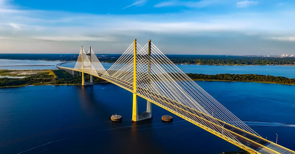
It is worth noting that man-made structures, such as buildings and bridges, can reach higher elevations than the natural landscape. For example, the Skyway Bridge in Tampa Bay stands at an impressive height of 430 feet (131 meters) above the water, providing breathtaking views of the surrounding area.
Although Florida may not have towering mountains or dramatic landscapes, its unique geography offers a different kind of beauty. The flat terrain allows for miles of pristine beaches, fertile agricultural lands, and diverse ecosystems that support a wide variety of plant and animal species.
For more information on Florida’s elevation and geography, you can visit the official website of the Visit Florida, the state’s official tourism website, or refer to the United States Geological Survey (USGS) for detailed topographic maps and data.
Factors That Shaped Florida’s Elevation
Geologic History and Limestone Base
Florida’s unique geologic history has played a significant role in shaping its elevation. The state is primarily composed of limestone, a sedimentary rock that is formed from the accumulation of marine organisms over millions of years.
This limestone base is responsible for the relatively low elevation of Florida compared to other states.
The formation of Florida’s limestone began millions of years ago during periods of high sea levels. As sea levels rose and fell, the marine organisms thrived and died, leaving behind their calcium-rich shells. Over time, these accumulated shells compacted and solidified into limestone.
The presence of limestone in Florida contributes to the state’s famous natural features, such as sinkholes and underground caves. These formations occur when acidic groundwater dissolves the limestone, creating voids and cavities beneath the surface.
Florida’s limestone base also affects the state’s topography. The porous nature of limestone allows for the formation of underground aquifers, which serve as important sources of freshwater for both human consumption and natural ecosystems.
Sea Level Changes Over Time
Another factor that has influenced Florida’s elevation is the fluctuation of sea levels over time. Due to its location, Florida is particularly vulnerable to changes in sea levels.
During the last ice age, when large amounts of water were locked up in glaciers, global sea levels were significantly lower than they are today. As the glaciers melted and the climate warmed, sea levels began to rise, gradually inundating coastal areas and reshaping the geography of Florida.
This ongoing rise in sea levels continues to impact Florida’s elevation. According to studies, the state’s coastline is experiencing an average sea-level rise of approximately 1 inch every 3 years. This gradual increase in sea levels can lead to coastal erosion, saltwater intrusion into freshwater sources, and increased vulnerability to storm surge and flooding.
Understanding the factors that have shaped Florida’s elevation is crucial for managing and planning for the state’s future. By considering the geological history and sea level changes, policymakers and scientists can develop strategies to mitigate the potential impacts of rising sea levels and protect Florida’s unique environment and communities.
Elevation’s Impact on Ecosystems
The average elevation of Florida may be relatively low compared to other states, but it still plays a crucial role in shaping its unique ecosystems. The diverse range of habitats found in Florida can be attributed to its varying elevations, which have a significant impact on the distribution of plant and animal species.
Wetlands and Swamps of Low Lands
Florida is known for its extensive wetlands and swamps, such as the Everglades and the Big Cypress Swamp. These low-lying areas are characterized by their rich biodiversity and unique ecosystems. The low elevation of these regions allows for the accumulation of water, creating the perfect conditions for wetland plants and animals to thrive.
The wetlands act as natural water filters, purifying the water and providing essential habitats for numerous species.
The Everglades, for example, is a vast subtropical wetland ecosystem that covers a large portion of southern Florida. It is home to a wide variety of plants and animals, many of which are found nowhere else in the world.
The unique combination of low elevation, abundant water supply, and warm climate creates an ideal environment for the growth of sawgrass, cypress trees, and other wetland vegetation.
These wetlands and swamps not only support a diverse array of wildlife but also provide essential services to humans. They help in flood control by absorbing excess water during heavy rains, preventing potential damage to nearby communities.
They also act as carbon sinks, absorbing and storing carbon dioxide from the atmosphere, thus mitigating the effects of climate change.
Upland Habitats in Higher Areas
While Florida is primarily known for its low-lying wetlands, it also has upland habitats that are found in higher elevation areas. These uplands are characterized by drier conditions and different plant and animal communities compared to the wetlands.
They play a crucial role in providing habitat for species that are adapted to living in drier environments.
One example of an upland habitat in Florida is the sandhill ecosystem. These areas, found in the central part of the state, consist of sandy soils and are dominated by longleaf pine trees. Sandhill habitats support a unique assemblage of plant and animal species, including gopher tortoises, indigo snakes, and various wildflowers.
The higher elevation of these areas allows for better drainage, resulting in drier conditions compared to the wetlands.
It is important to note that elevation is not the sole factor determining the distribution of Florida’s ecosystems. Other factors such as soil type, climate, and human activities also play significant roles.
However, elevation remains a critical component in understanding the diversity and distribution of habitats in the state.
For more information on Florida’s ecosystems and the impact of elevation, you can visit the Florida Museum website, which provides valuable resources and research on the topic.
Human Development and Topography
Draining Wetlands for Development
One of the ways human development has impacted Florida’s topography is through the draining of wetlands. Wetlands are low-lying areas that are often characterized by high water levels and unique ecosystems. However, these areas have also been seen as valuable land for development.
Over the years, many wetlands in Florida have been drained to make way for residential and commercial projects.
This practice of draining wetlands has had both positive and negative effects on the state. On one hand, it has allowed for the expansion of urban areas and the creation of new infrastructure. On the other hand, it has resulted in the loss of valuable natural habitats and has contributed to environmental issues such as water pollution and reduced biodiversity.
Organizations like the Florida Department of Environmental Protection have recognized the importance of preserving wetlands and have implemented regulations to protect them. These regulations aim to strike a balance between development and conservation, ensuring that Florida’s unique wetland ecosystems are preserved for future generations to enjoy.
Elevation’s Role in Settlement Patterns
The elevation of a region plays a significant role in the patterns of human settlement. In the case of Florida, where the average elevation is relatively low, settlements tend to be concentrated in coastal areas and along major water bodies such as rivers and lakes.
This preference for coastal and low-lying areas is driven by several factors. Firstly, these areas provide easy access to transportation routes, enabling trade and commerce to flourish. Additionally, coastal areas often offer scenic views and recreational opportunities, making them attractive places to live and visit.
However, the low elevation of Florida also presents certain challenges. Coastal areas are more vulnerable to the impacts of climate change, including rising sea levels and increased storm activity. As a result, these areas may face increased risks of flooding and erosion.
It is important for policymakers and residents alike to consider the potential risks and benefits associated with settlement patterns in low-lying areas. By taking into account factors such as elevation, climate change projections, and sustainable development practices, Florida can continue to thrive while also protecting its natural resources and ensuring the well-being of its residents.
Conclusion
While often viewed as a flat, low-lying state, Florida’s average elevation of 100 feet masks great diversity in its terrain. Understanding factors that shaped its topography, and how elevation influences ecosystems and settlement, provides insight into the Sunshine State’s natural environments and human history.