When Will Florida Be Underwater? Examining The Impact Of Rising Sea Levels
Rising sea levels threaten to reshape Florida’s iconic coastlines and communities in the coming decades. But when exactly could widespread flooding occur across the Sunshine State? Understanding projections and vulnerabilities is key to planning for impacts.
If you’re short on time, here’s a quick answer: Based on current projections, parts of South Florida and the Keys could see frequent flooding by 2040-2060. But the whole state won’t be underwater anytime soon. Still, higher waters will likely reshape Florida’s coast over this century.
Sea Level Rise Projections and Predictions for Florida
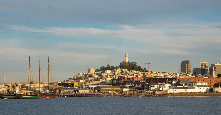
As the global climate continues to change, the threat of rising sea levels becomes a growing concern for coastal regions around the world. Florida, with its extensive coastline and low-lying terrain, is particularly vulnerable to the effects of sea level rise.
In this section, we will explore the projections and predictions for sea level rise in Florida, providing valuable insights into the potential impact on the state.
Global Sea Level Rise Estimates
According to the Intergovernmental Panel on Climate Change (IPCC), global sea levels have been rising at an average rate of 3.2 millimeters per year since the early 1990s. However, this rate is expected to accelerate in the coming decades due to the melting of glaciers and ice sheets, as well as the thermal expansion of seawater caused by global warming.
While the exact magnitude and timing of sea level rise in Florida are uncertain, various studies and models have provided valuable projections. For instance, a study published in Nature Climate Change predicts that by 2100, sea levels in Florida could rise by as much as 2.5 feet under a high-emissions scenario.
Another study conducted by the United States Geological Survey (USGS) suggests a range of 0.6 to 1.2 meters (2 to 4 feet) by 2100.
Factors That Affect Florida’s Vulnerability
Several factors contribute to Florida’s vulnerability to sea level rise. First and foremost is the state’s flat topography, with large portions of land situated just a few feet above sea level. This makes even slight increases in sea level particularly impactful, leading to increased flooding and erosion.
Furthermore, Florida’s porous limestone bedrock allows seawater to infiltrate underground, leading to saltwater intrusion into freshwater sources. This poses significant challenges for the state’s drinking water supply and agricultural irrigation systems.
The impact of sea level rise is also exacerbated by factors such as coastal development, storm surge events, and the loss of natural barriers like mangrove forests and sand dunes, which provide protection against erosion and flooding.
Statewide Impact Predictions
The projected sea level rise in Florida will have wide-ranging impacts on various aspects of the state’s infrastructure, economy, and natural environment. Coastal communities will face increased risks of flooding and storm surge events, leading to potential damage to homes, businesses, and critical infrastructure.
Furthermore, the tourism industry, which is a major economic driver in Florida, may be severely affected as popular beach destinations become increasingly vulnerable to erosion and inundation. The loss of coastal habitats, such as coral reefs and wetlands, could also have detrimental effects on biodiversity and ecosystem services.
It is important for policymakers, urban planners, and residents to take proactive measures to mitigate the impacts of sea level rise in Florida. This includes implementing coastal management strategies, promoting sustainable development practices, and investing in infrastructure improvements to enhance resilience.
For more information on sea level rise and its impact on Florida, you can visit the official website of the National Oceanic and Atmospheric Administration (NOAA) at https://www.noaa.gov/.
Regional Differences in Timeframes and Threats
South Florida and the Keys
When it comes to the impact of rising sea levels, South Florida and the Florida Keys are particularly vulnerable. With its low-lying coastal areas and porous limestone bedrock, this region is already experiencing the effects of sea-level rise.
In fact, according to a study by the Union of Concerned Scientists, Miami could see a sea-level rise of up to 17 inches by 2040. This would result in increased flooding, saltwater intrusion into freshwater supplies, and damage to infrastructure and property.
The unique ecosystem of the Everglades is also at risk, as rising sea levels threaten to disrupt the delicate balance of freshwater and saltwater in the area.
Miami Metro and Southeast Coast
The Miami metropolitan area and the Southeast Coast of Florida, including cities like Fort Lauderdale and West Palm Beach, are also facing significant threats from rising sea levels. As a major economic hub and home to millions of people, the impact of sea-level rise in this region would be substantial.
A report by the Southeast Florida Regional Climate Change Compact estimates that by 2100, the Miami area could experience a sea-level rise of up to 6 feet. This would put billions of dollars of property at risk, threaten critical infrastructure such as airports and seaports, and displace large numbers of residents.
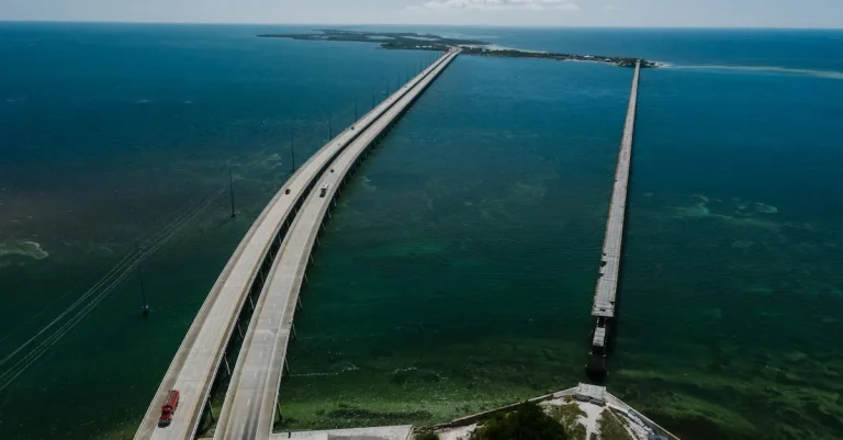
Tampa Bay, Southwest Florida and Panhandle
While South Florida and the Miami metro area often take the spotlight when it comes to discussions about rising sea levels, other regions of Florida are also at risk. Tampa Bay, Southwest Florida, and the Panhandle are facing their own set of challenges.
Tampa Bay, for example, is susceptible to storm surge and the potential for increased flooding. A study by the Tampa Bay Regional Planning Council projects that by 2050, the bay area could see a sea-level rise of up to 2.5 feet.
Along the Southwest coast, communities like Naples and Sarasota are grappling with the erosion of beaches and the loss of valuable coastal habitats. In the Panhandle, rising sea levels could exacerbate the impact of hurricanes and tropical storms, which are already a frequent occurrence in the region.
It is important to note that the projected timeframes and threats outlined above are based on current scientific research, but they are subject to change as our understanding of climate change and sea-level rise continues to evolve.
To stay informed about the latest developments and research in this field, it is recommended to visit reputable sources such as the National Oceanic and Atmospheric Administration (NOAA) and the Intergovernmental Panel on Climate Change (IPCC).
Planning Adaptation Strategies for Resilience
As the threat of rising sea levels looms over Florida, it is crucial to plan adaptation strategies that will ensure the state’s resilience in the face of this environmental challenge. Various approaches can be taken to mitigate the impact of rising sea levels, including infrastructure and home elevation, the implementation of natural and manmade barriers, policy changes and future zoning, as well as exploring relocation and migration possibilities.
Infrastructure and Home Elevation
One of the key adaptation strategies for Florida is to invest in the elevation of infrastructure and homes in vulnerable areas. By raising buildings and critical infrastructure above projected flood levels, communities can better protect themselves from the impacts of rising sea levels.
This can involve retrofitting existing structures or constructing new buildings with elevated foundations.
Natural and Manmade Barriers
Another effective approach is the implementation of natural and manmade barriers to protect coastal areas from the encroaching waters. This can include the restoration and creation of coastal wetlands, dunes, and reefs that act as natural buffers against storm surges and tidal flooding.
Additionally, the construction of seawalls, levees, and other manmade barriers can provide further protection against rising sea levels.
Policy Changes and Future Zoning
Adapting to rising sea levels also requires significant policy changes and future zoning considerations. Governments and local authorities should implement stricter building codes and regulations to ensure that new construction projects are resilient to flooding and other climate-related hazards.
Moreover, zoning guidelines should be revised to discourage development in high-risk areas and promote the relocation of vulnerable communities to safer locations.
Relocation and Migration Possibilities
In some cases, relocation and migration may become necessary as a long-term adaptation strategy. This could involve the voluntary or assisted relocation of communities that are at the highest risk of being submerged by rising sea levels.
It is essential to consider the social, economic, and cultural impacts of such relocations and ensure that affected individuals receive the necessary support and resources.
By implementing a combination of these adaptation strategies, Florida can enhance its resilience and mitigate the potential impact of rising sea levels. It is important for policymakers, scientists, and communities to work together to develop comprehensive plans that prioritize the safety and well-being of its residents while protecting the unique ecosystems and coastal areas that make Florida such a beloved state.
Visualizing Florida’s Coastline Change
As the threat of rising sea levels looms over Florida, it is crucial to understand the potential impact on the state’s coastline. Visualizing the changes that could occur can help us comprehend the magnitude of the situation and take necessary measures to mitigate the risks.
Interactive Maps and Charts
One effective way to visualize the impact of rising sea levels on Florida’s coastline is through interactive maps and charts. These tools allow users to explore different scenarios and see how various regions could be affected.
They provide valuable insights into which areas are most at risk and help policymakers and residents make informed decisions regarding land use, infrastructure development, and coastal management strategies.
For instance, the National Oceanic and Atmospheric Administration (NOAA) offers an interactive sea level rise viewer that allows users to visualize sea level rise scenarios for different time frames. This tool provides valuable information on the potential inundation of coastal areas and the extent to which various landmarks, cities, and neighborhoods could be affected.
Another useful resource is the Coastal Risk Screening Tool developed by the Environmental Protection Agency (EPA). This tool provides a comprehensive assessment of social, economic, and environmental vulnerabilities of coastal areas to sea level rise.
It allows users to explore various data layers, such as population density, infrastructure, and environmental factors, to understand the potential impact on communities and ecosystems.
Seeing Change at the Local Level
While interactive maps and charts provide a broad understanding of the potential impact of rising sea levels, it is equally important to see the changes at the local level. By focusing on specific communities and regions, we can better appreciate the immediate risks and challenges they face.
Local governments and organizations have taken initiatives to visualize the impact of rising sea levels through community engagement and awareness programs. They organize public events, workshops, and exhibitions where residents can learn about the potential impacts, discuss adaptation strategies, and contribute to the decision-making process.
For example, the City of Miami Beach has developed the “Miami Forever” initiative, which includes interactive exhibits and virtual reality experiences that allow residents and visitors to see firsthand the projected impacts of sea level rise on their neighborhoods.
This initiative not only raises awareness but also fosters a sense of urgency and collective responsibility towards addressing the issue.
By visualizing the potential impact of rising sea levels through interactive maps, charts, and local-level initiatives, we can better understand the challenges that lie ahead and work towards finding sustainable solutions.
It is essential to involve all stakeholders in the decision-making process and take immediate action to mitigate the risks associated with climate change.
Conclusion
While Florida may not be fully underwater for decades or longer, higher sea levels will reshape coastlines, real estate, and quality of life over this century. Preparing communities and infrastructure to handle flooding will be crucial in the years ahead. With smart adaptation strategies, the Sunshine State can mitigate risks while retaining its coastal identity and economic vitality.
By understanding sea level rise projections for different regions, Florida residents and officials can make informed choices when planning for the future.